MSG-3's First Image
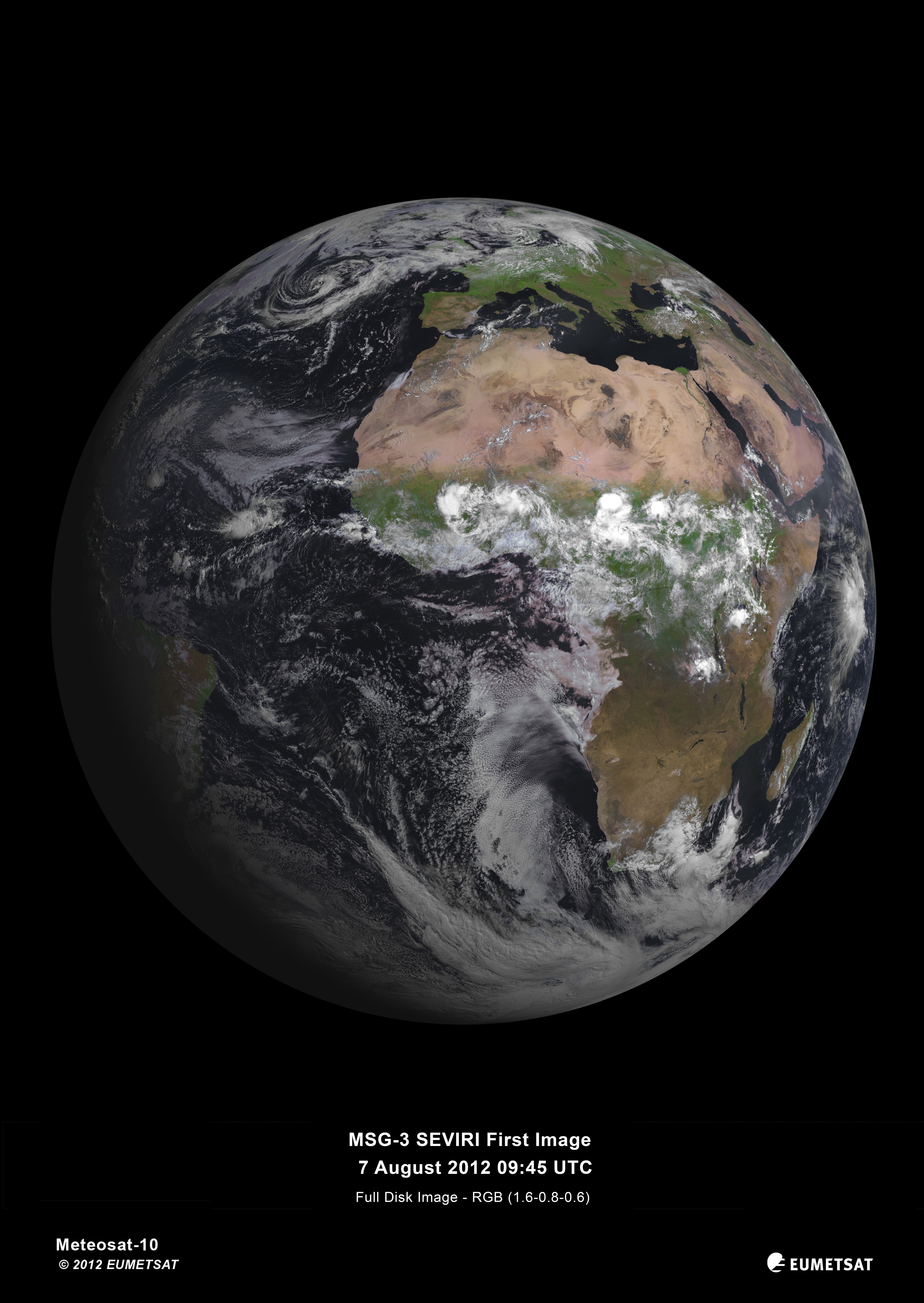
MSG-3, the new European weather satellite which is in geosynchronous orbit, has taken this stunning picture of Earth from approximately 36,000km away. Here’s how far that is (courtesy of Wikipedia):
Today, the Spinning Enhanced Visible and Infrared Imager (SEVIRI) instrument on MSG-3 captured its first image of the Earth. This demonstrates that Europe’s latest geostationary weather satellite, launched on 5 July, is performing well and is on its way to taking over operational service after six months of commissioning.
The European Space Agency (ESA) was responsible for the initial operations after launch (the so-called launch and early orbit phase) of MSG-3 and handed over the satellite to EUMETSAT on 16 July.
The first image is a joint achievement by ESA, EUMETSAT, and the European space industry. For its mandatory programmes, EUMETSAT relies on ESA for the development of new satellites and the procurement of recurrent satellites like MSG-3. This cooperation model has made Europe a world leader in satellite meteorology by making best use of the respective expertise of the two agencies.
via/more at ESA